
Things to do in Kuala Lumpur
Known for
Petronas Twin Towers and a mix of Malay, Chinese and Indian culture
Must-see landmarks
Petronas Twin Towers, Batu Caves and Thean Hou Temple
Best time to visit
Warm and humid year-round, with the least rain around June and July
Free to visit
Merdeka Square, KLCC Park and the main Temple Cave at Batu Caves
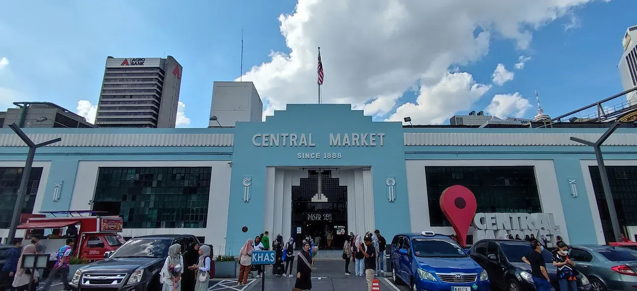
1. Central Market
Central Market opened in 1888 as the city's wet market and now trades as a covered hall of Malaysian craft, with batik, pewter, wood carving and souvenir stalls on the ground floor and Malay, Chinese and Nyonya food stalls above. The pale blue Art Deco building dates from 1937 and reopened in 1986 as Pasar Seni, the name the rail station outside still carries. Cultural performances run on the ground floor stage from time to time, and the covered lanes of Petaling Street are a short walk east.
Style: Art Deco
Location: Jalan Hang Kasturi, 50050 Kuala Lumpur.
Access: Free to walk through, open daily from 10am to 10pm.
Photo: "The art deco facade of Central Market (Pasar Seni), Kuala Lumpur" by Wee Hong (CC BY-SA 4.0).
2. Batu Caves
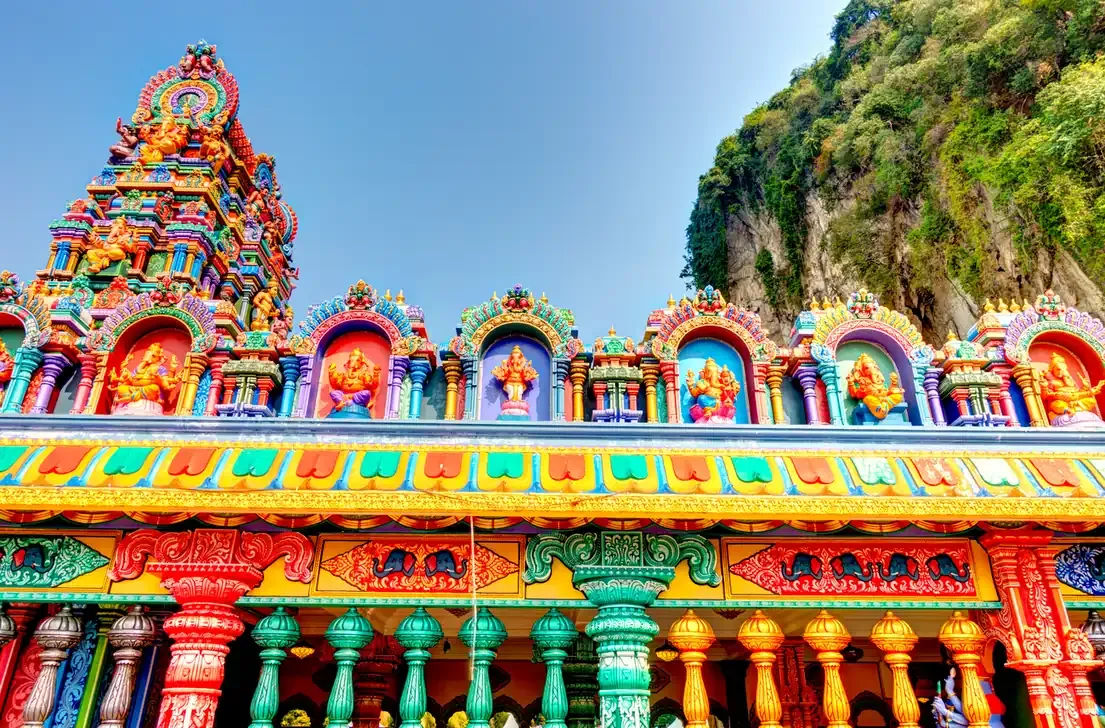
A limestone massif in Gombak, north of the city, shelters the shrines where Tamil Hindus have gathered for more than a century. Tourism Malaysia puts the age of the rock at over 400 million years and the golden statue of Lord Murugan at the foot of the stairs at over 40 metres. Behind it, 272 steps painted red, yellow, blue and green climb to the Temple Cave, with the Dark Cave branching off at the 204th step. Macaques patrol the whole staircase, so loose food and bags stay closed.
Location: Gombak, Selangor, reached by KTM Komuter to Batu Caves station and a five minute walk.
Access: Free to enter the main Temple Cave. The Ramayana Cave and Dark Cave charge separately, and mornings before 8am are the quietest.
3. Petronas Twin Towers
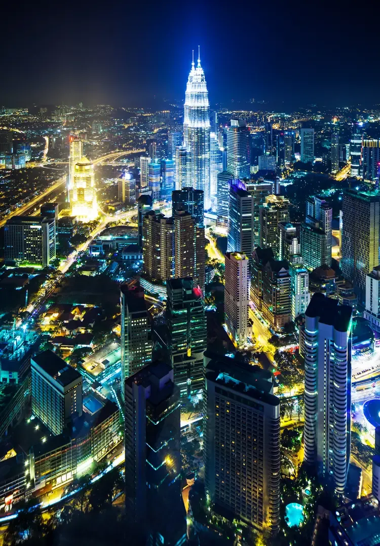
Cesar Pelli's twin towers climb 452 metres above the Golden Triangle and were the tallest building in the world from 1998 to 2004. A double decker Skybridge links them at levels 41 and 42, the observation deck sits on the 86th floor, and every floor plate follows two interlocking squares that draw an eight pointed star from Islamic geometry. Suria KLCC fills the podium below, and KLCC Park wraps the base in lawns, a lake and the Lake Symphony fountain show that plays most evenings.
Architect: Cesar Pelli · Style: Postmodern
Location: Kuala Lumpur City Centre, beside Suria KLCC.
Access: The park and the view from below cost nothing. Skybridge and deck are ticketed, open Tuesday to Sunday, and on Mondays only the second, fourth and fifth of the month.
4. Menara Kuala Lumpur (KL Tower)
The telecommunications tower on Bukit Nanas rises 421 metres above a patch of the oldest forest reserve in the country. Opened in 1996 to a design by Achmad Moerdijat, with a head shaped like a Malay spinning top, it holds an enclosed observation deck at 276 metres and, higher up, the open-air Sky Deck at 300 metres with glass Sky Boxes cantilevered over the drop. A revolving restaurant turns below the decks. At the foot, the KL Forest Eco Park runs a canopy walk through the trees. The tower reopened in April 2025 under new management.
Architect: Achmad Moerdijat · Height: 421 m · Opened: 1996
Location: 2 Jalan Punchak, Bukit Nanas
Access: Ticketed; the Observation Deck and the Sky Deck have separate tickets
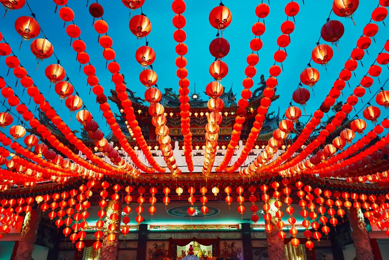
5. Thean Hou Temple
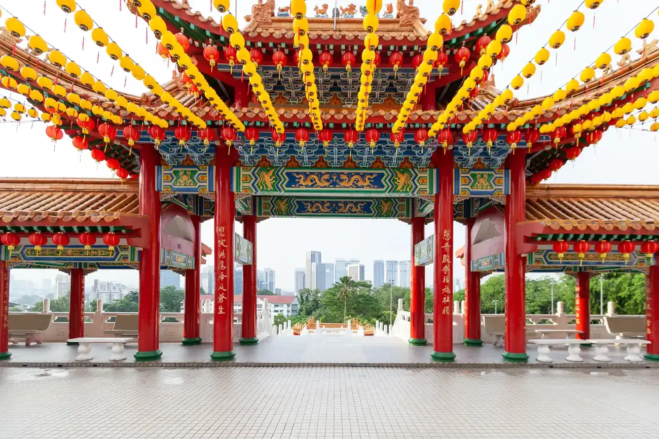
Six tiers of red columns, dragon ridges and curved eaves crown a hill south of the old town, raised by the Selangor and Federal Territory Hainan Association and dedicated to Mazu, the Chinese goddess of the sea. Courtyards strung with hundreds of red lanterns frame wide views over the Kuala Lumpur skyline, at their busiest around Chinese New Year and the Mid Autumn Festival. A marriage registry and a banquet hall share the grounds, which keeps weekends lively.
Location: 65 Persiaran Endah, off Jalan Syed Putra, 50460 Kuala Lumpur.
Access: Free, with the main shrine open daily from 8am to 8pm, public holidays included.
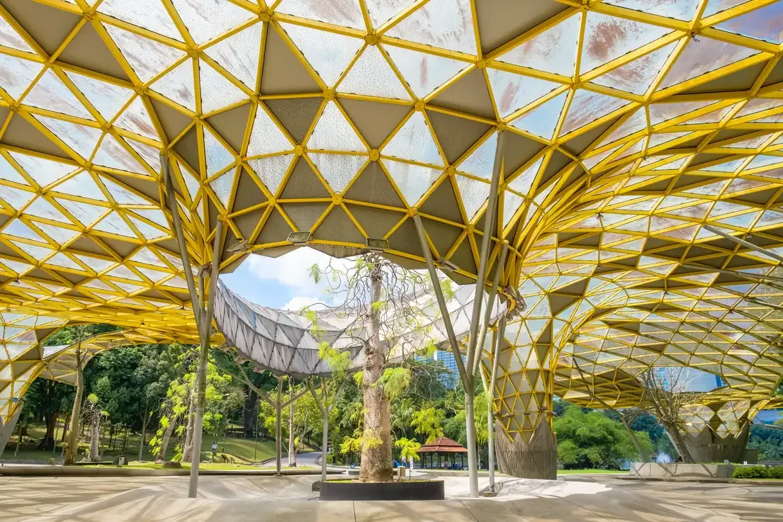
6. Perdana Botanical Gardens
Laid out in 1888 on the slopes west of the old town, the Lake Gardens remain the green lung of central Kuala Lumpur, with a boating lake, shaded lawns, a herb garden and stands of palms and rain trees across the hillside. Malaysia lists the grounds as a national natural historic site. Masjid Negara, the Islamic Arts Museum and the bird park all open onto its edges, so the park doubles as the link between them and a shortcut back to the old town.
Location: west of the old town, between Masjid Negara and the Kuala Lumpur Bird Park.
Access: Free to wander. The Orchid Garden, Hibiscus Garden and the bird park inside charge their own admission.
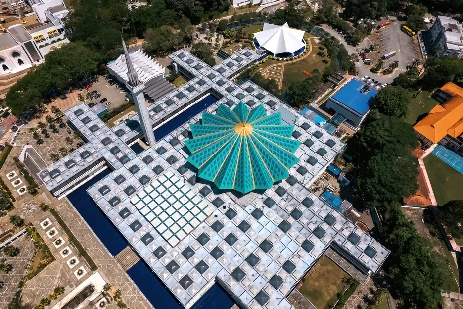
7. Masjid Negara (National Mosque)
Malaysia's national mosque was built between 1963 and 27 August 1965 on thirteen acres beside the old railway station, with room for fifteen thousand worshippers. The design came from the research team of the Public Works Department under Baharuddin Abu Kassim, who studied mosques from Spain to Iran before drawing a folded concrete roof shaped like an open umbrella and a minaret of about 75 metres shaped like a closed one. A separate entrance and facilities are set aside for visitors.
Architect: Baharuddin Abu Kassim · Style: Modern
Location: Jalan Perdana, between the Lake Gardens and the old railway station.
Access: Free, open to non-Muslim visitors outside prayer times, with robes loaned at the door.
8. Sri Mahamariamman Temple
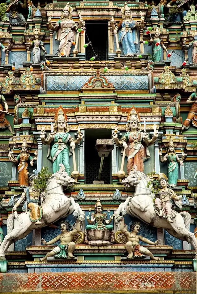
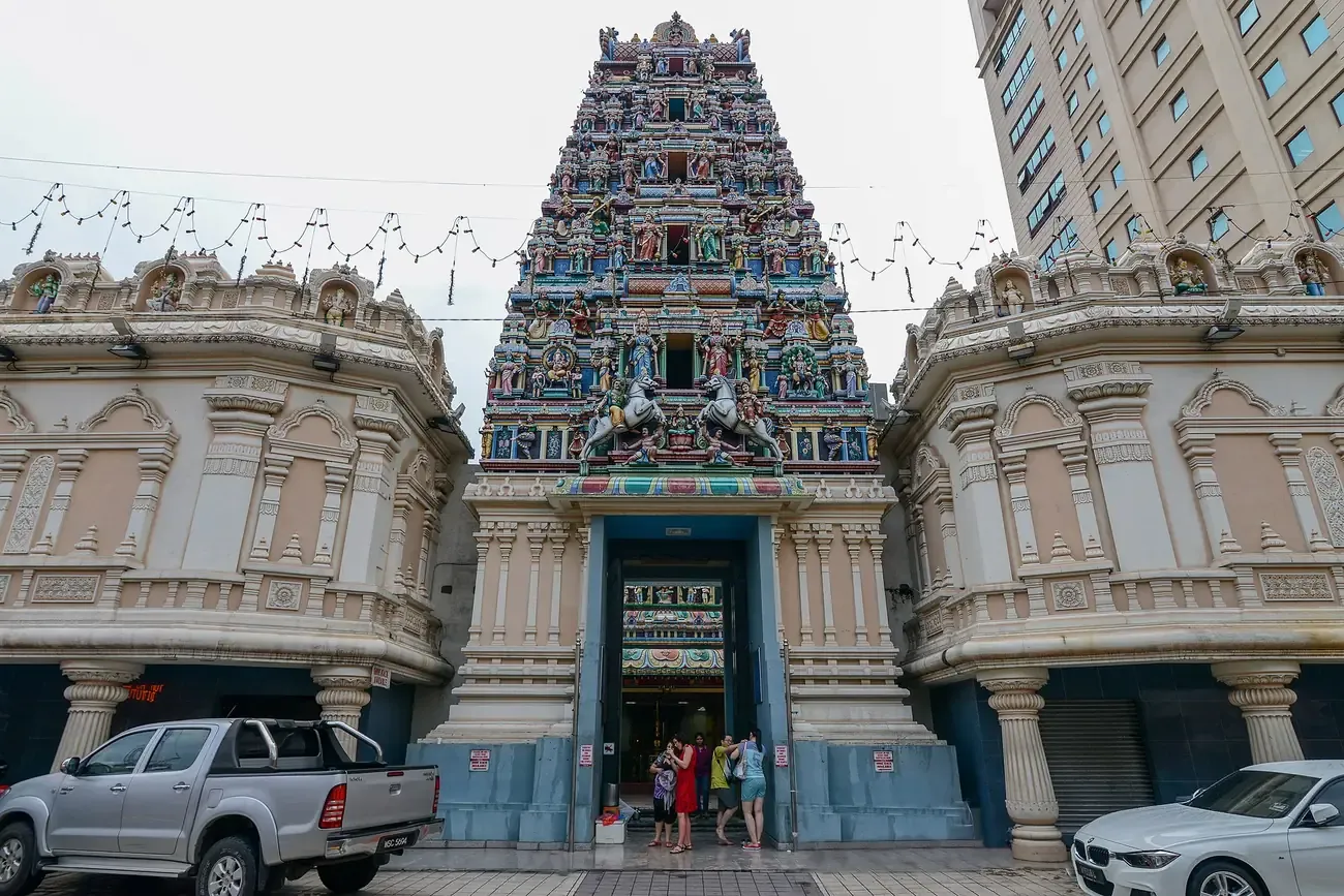
The oldest Hindu temple in Kuala Lumpur began in 1873 as a private shrine and opened to the wider public in the 1920s. Its tiered gopuram, added in a rebuild finished in 1968, stacks rows of painted deities above the doorway on Jalan Tun H S Lee, on the eastern edge of Chinatown. The temple's silver chariot leads the Thaipusam procession out to Batu Caves each year, and the gopuram looks its most vivid once it is lit after dark.
Location: Jalan Tun H S Lee, at the edge of Chinatown.
Access: Free at the door. Shoes come off before entering and a small charge applies to store them.
Photo: "The gopuram tower of Sri Mahamariamman Temple, Kuala Lumpur" by Jorge Láscar (CC BY 2.0).
9. Masjid Jamek
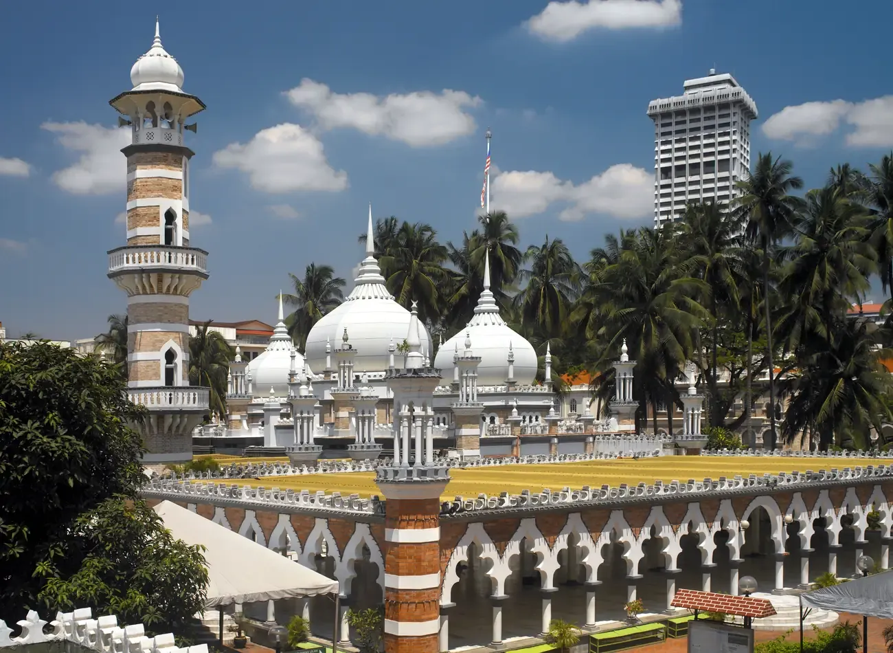
The oldest surviving mosque in the city stands on the spit of land where the Klang and Gombak rivers meet, the muddy confluence that gave Kuala Lumpur its name. Arthur Benison Hubback drew it in a Mughal idiom of onion domes, banded brick minarets and a long arcaded prayer hall, and it served as the main mosque of the capital until Masjid Negara opened in 1965. Palms screen the riverside terrace, and the Masjid Jamek interchange brings several rail lines to the gate.
Architect: Arthur Benison Hubback
Location: Jalan Tun Perak, at the Klang and Gombak confluence.
Access: Open to visitors outside prayer times, with robes provided at the entrance.
10. Petaling Street
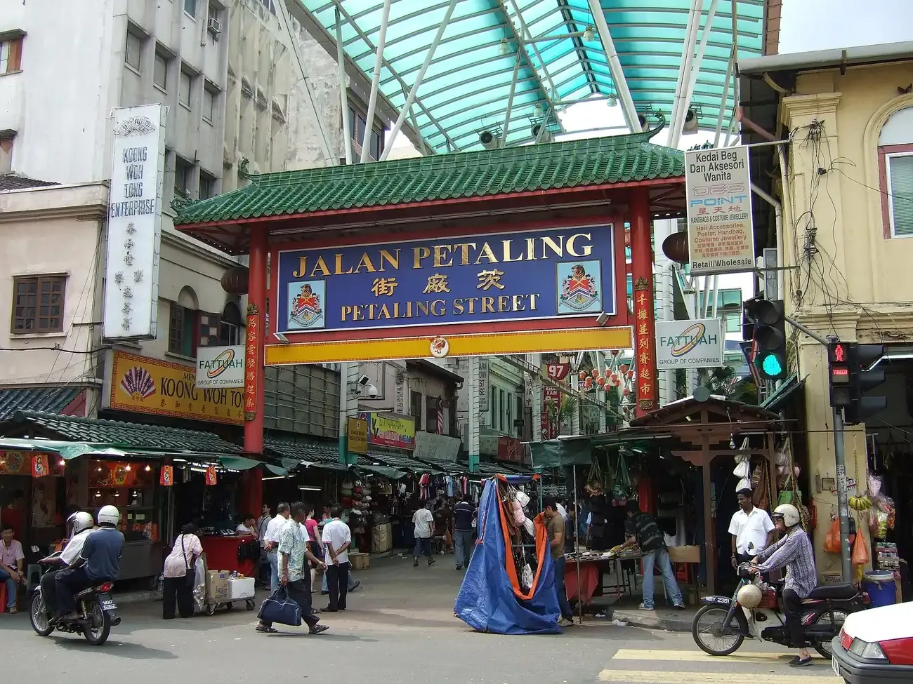
Chinatown's market street has traded since the 1870s, when Cantonese speakers knew it as Chee Cheong Kai, Starch Factory Street. A red arch marks the entrance to lanes strung with lanterns and canvas awnings, where stalls of clothes, souvenirs, fruit and street food take over once the heat drops after dark. The grid of shophouses around it holds kopitiams and herbal shops, the Sri Mahamariamman Temple stands three minutes away on foot, and Pasar Seni station sits at the top of the street.
Location: Jalan Petaling, Chinatown.
Access: Free to walk at any hour.
Photo: "The Green Dragon entrance gate to Petaling Street, Kuala Lumpur" by Goosmurft (CC BY-SA 2.0).
Free attractions to visit in Kuala Lumpur
Merdeka Square
The former colonial cricket pitch is open around the clock and free to cross, its lawns framed by the Sultan Abdul Samad Building's domes and the mock-Tudor Royal Selangor Club. A marker on the field shows where Malaysia's flag first went up in 1957.
GOKL City Bus
Kuala Lumpur City Hall's electric bus loops run free across downtown and out to the transit hubs, a no-cost way to shuttle between Merdeka Square, KLCC and Chinatown without a taxi.
What makes Kuala Lumpur special
Kuala Lumpur grew up at the confluence of the Klang and Gombak rivers, where Chinese tin miners set up a trading post in the 1850s that gave the city its name, muddy river mouth. That mining camp became a British administrative capital, then the capital of independent Malaysia in 1957, and the layers still show: colonial Moorish domes face a Hindu temple across one street, a Chinese shophouse row down the next, and the glass towers of the Golden Triangle a short ride away.
A meeting point of cultures
Malay, Chinese and Indian communities have shared the city since its earliest mining days, and that mix still shows in its food, festivals and skyline. Mosque calls to prayer, temple incense and Hindu processions overlap within walking distance of each other, nowhere more so than around Masjid Jamek and Chinatown.
Neighbourhoods to know
Merdeka Square and the old colonial core sit beside Chinatown's Petaling Street and the Little India of Brickfields, walkable to each other around the river confluence. The Golden Triangle, built up around KLCC and the Petronas Twin Towers, holds the malls and skyscrapers, while Bukit Bintang next door adds shopping, hawker streets and nightlife.
When to go and for how long
Kuala Lumpur sits close enough to the equator that there is no real dry season; expect warm, humid weather and the chance of an afternoon downpour at any time of year. The wetter northeast monsoon runs roughly from December to March, while June and July tend to bring the least rain. Three to four days cover the old town, KLCC and a trip out to Batu Caves at an easy pace.
Getting around
The LRT, MRT, monorail and KTM Komuter trains connect the city's districts and its airport rail links, with the free GOKL bus looping around downtown between them. Merdeka Square, Chinatown and the old colonial core are easily walkable to each other, though the Golden Triangle around KLCC is better reached by train than on foot in the heat. Kuala Lumpur is within two hours' flight of Singapore, Bangkok and Jakarta, which makes it a practical base for a wider sweep of what to do in asia.