
Amsterdam City Centre Map
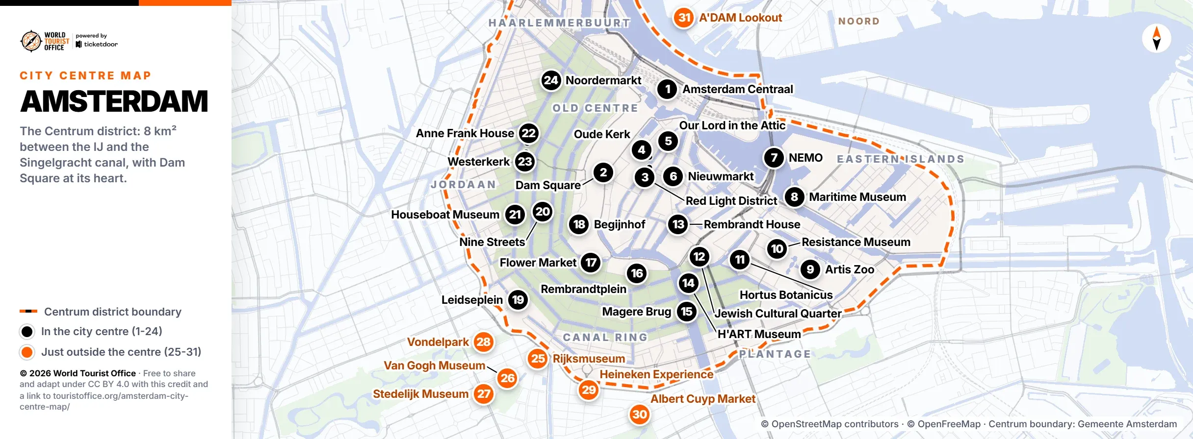
The centre of Amsterdam is the Centrum district: the old city between the IJ and the Singelgracht canal, with Dam Square at its heart. This map numbers 24 sights inside it and 7 just outside, free to view, print and share.
Opening details and tickets for each sight are in the guide to things to do in Amsterdam, and the Amsterdam tourist office page explains where to pick up a paper map.
Where is the centre of Amsterdam
Amsterdam is divided into nine districts, and the one called Centrum is the city centre. It covers about 8 km² of the old city, from the IJ waterfront behind Amsterdam Centraal in the north to the Singelgracht, the canal that curves round it on the land side. The black dashed line on the map follows the district boundaries published by the City of Amsterdam.
Dam Square is its heart and Amsterdam Centraal its front door. Inside lie the medieval Old Centre with the Red Light District, the 17th century Canal Ring, a UNESCO World Heritage Site since 2010, the Jordaan, the Haarlemmerbuurt, the Plantage and the Eastern Islands.
The centre is small enough to walk. These times were measured along the streets at an easy pace, without stops:
| Walk | Distance | On foot |
|---|---|---|
| Amsterdam Centraal to Dam Square | 0.9 km | 11 min |
| Dam Square to the Begijnhof | 0.5 km | 6 min |
| Dam Square to the Anne Frank House | 0.8 km | 10 min |
| Dam Square to Rembrandtplein | 1.0 km | 11 min |
| Dam Square to Leidseplein | 1.4 km | 16 min |
| Dam Square to the Hortus Botanicus | 1.4 km | 17 min |
| Dam Square to the Rijksmuseum | 1.9 km | 22 min |
| Amsterdam Centraal to the Rijksmuseum | 2.7 km | 33 min |
Museumplein, with the Rijksmuseum and the Van Gogh Museum, and De Pijp, with the Heineken Experience, are just outside, across the Singelgracht in the Zuid district. The map marks them in orange.
What to see in the city centre of Amsterdam
The numbers match the pins on the map and in the PDF, in a loop from Amsterdam Centraal: the Old Centre, east to the docks and the Plantage, south along the Canal Ring and back north through the Jordaan.
1. Amsterdam Centraal
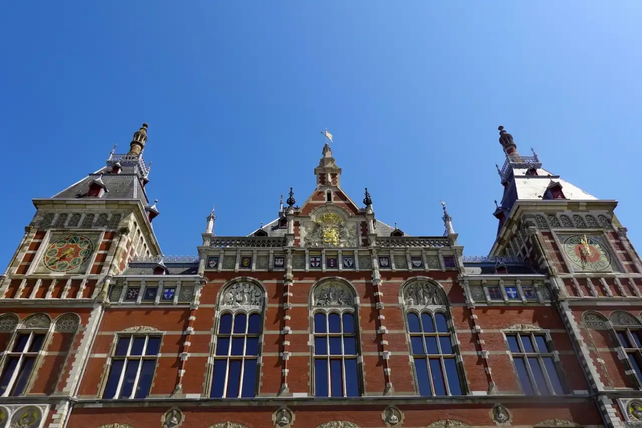
The main railway station, opened in 1889 on artificial islands in the IJ and designed by Pierre Cuypers, the architect of the Rijksmuseum. Trains from Schiphol, trams, the metro and the free ferries to Noord all leave from here.
2. Dam Square
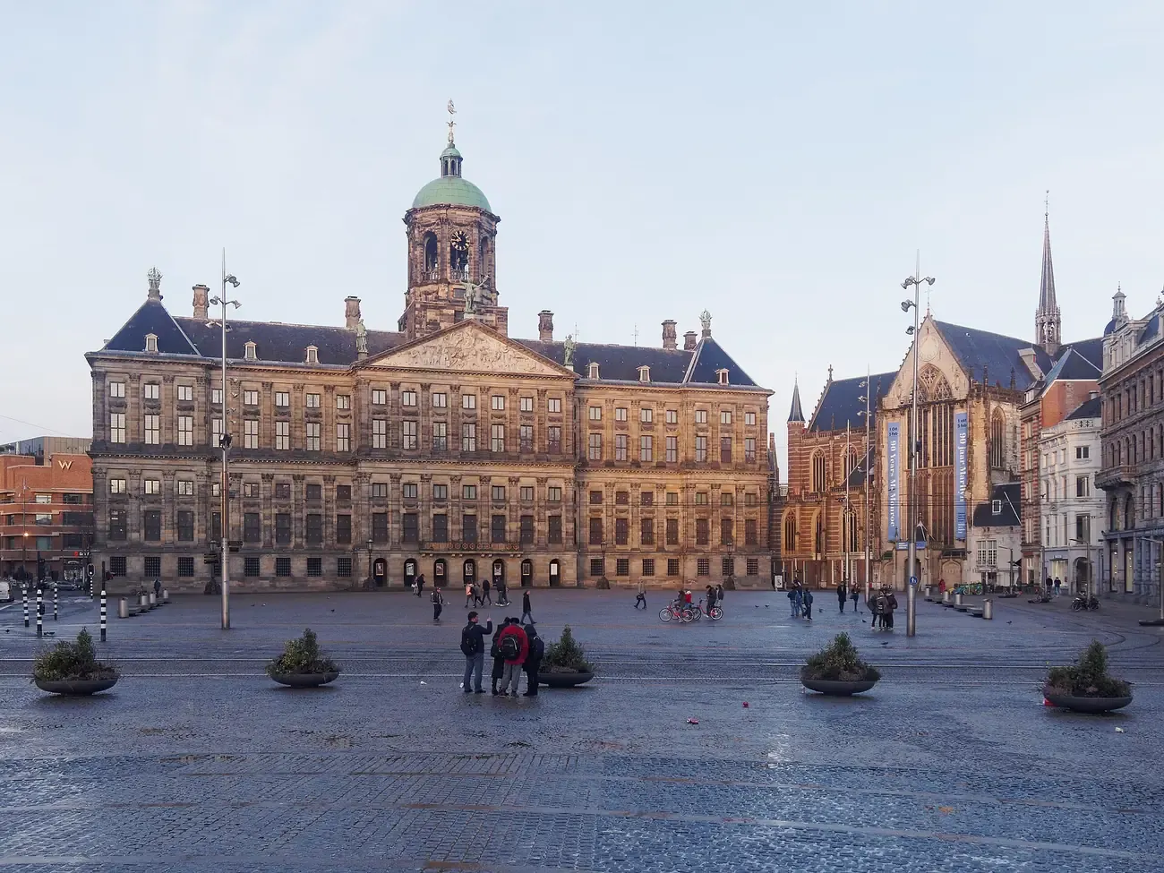
The square on the dam across the Amstel that gave the city its name, with the Royal Palace, the Nieuwe Kerk and the National Monument. Most walks across the centre pass through it.
Photo: "Dam Amsterdam" by C messier (CC BY-SA 4.0).
3. Red Light District
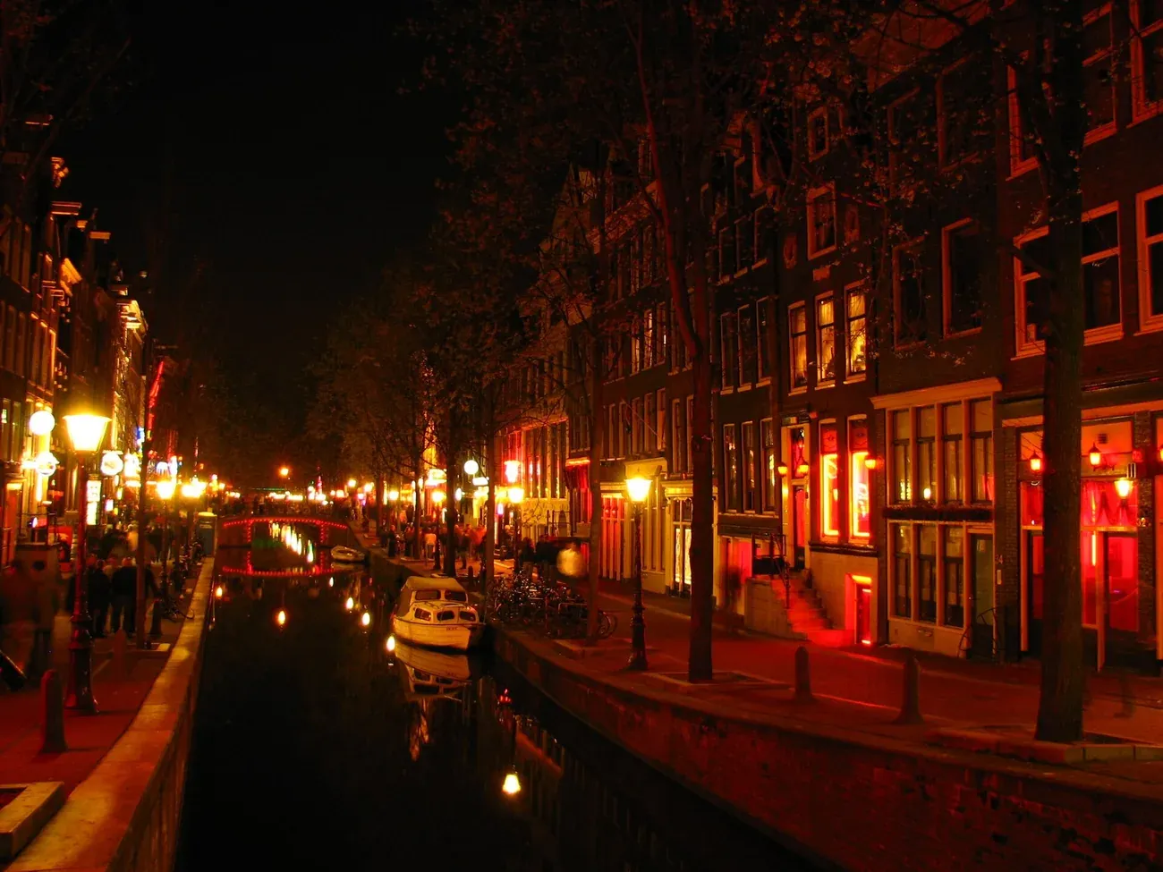
De Wallen, the oldest part of the city, along the Oudezijds Voorburgwal and Oudezijds Achterburgwal canals. Smoking cannabis in its streets is banned, and photos of the windows are not welcome.
Photo: "De Wallen" by Rungbachduong (CC BY-SA 3.0).
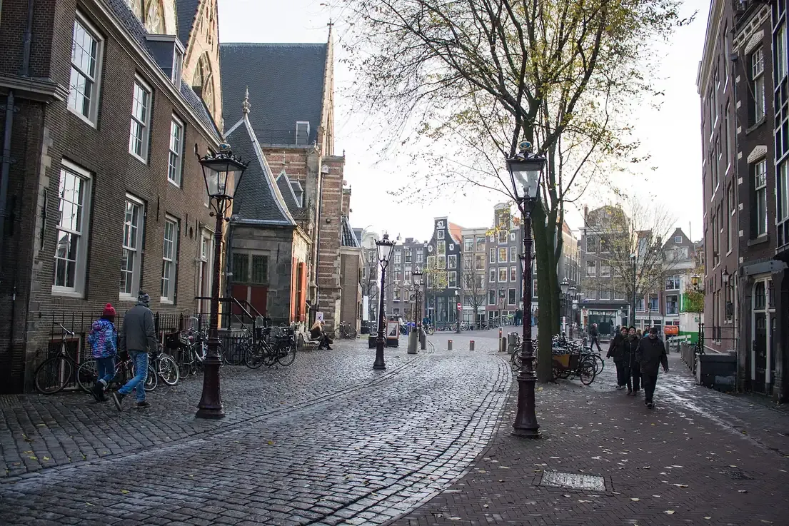
4. Oude Kerk
The oldest building in Amsterdam, a church consecrated in 1306, standing in the middle of the Red Light District. Rembrandt's wife Saskia is buried here.
Photo: "Oudekerksplein beside the Oude Kerk" by Shadowgate (CC BY 2.0).
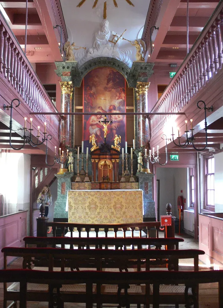
5. Our Lord in the Attic
A 1630 canal house hiding a complete Catholic church across its top floors, built in the 1660s when Catholics could not worship in public. It has been a museum since 1888.
Photo: "Amsterdam - Museum Ons' Lieve Heer op Solder - hidden church" by Remi Mathis (CC BY-SA 3.0).
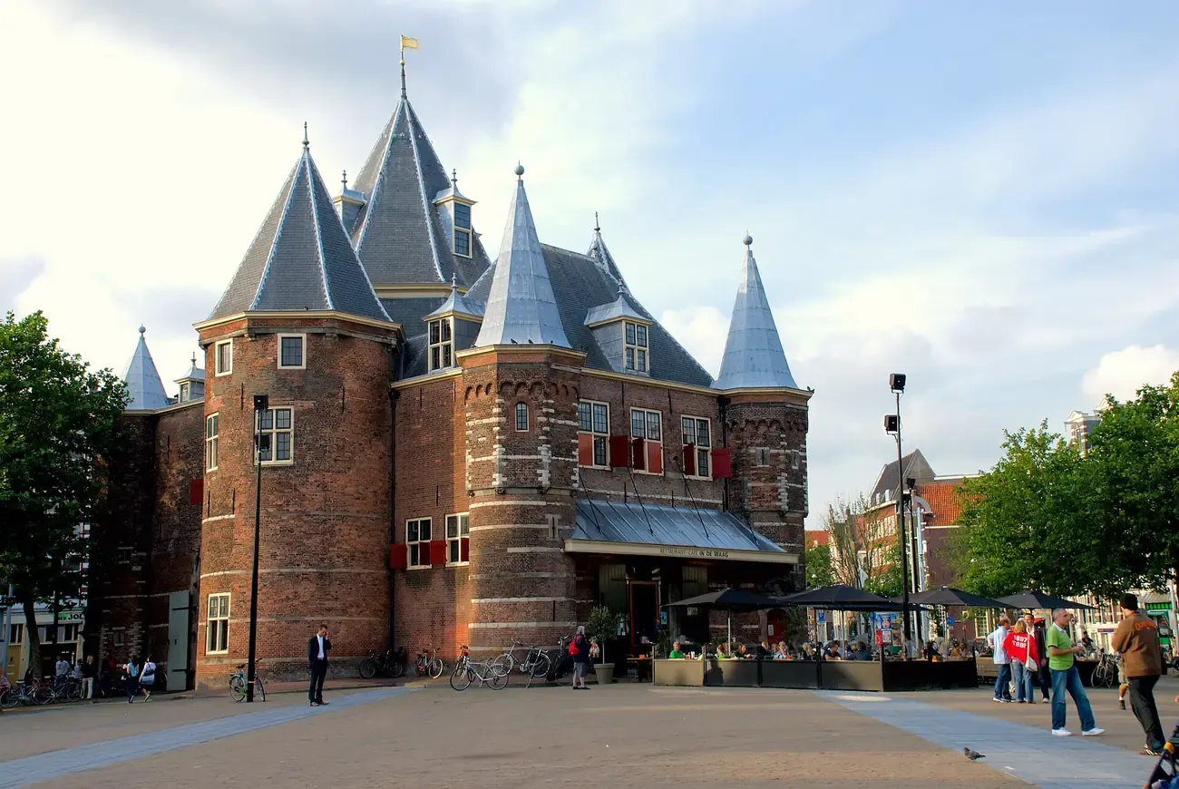
6. Nieuwmarkt
A square of cafés around De Waag, a 15th century city gate later used as a weigh house, with a farmers' market on Saturdays.
Photo: "Waag Amsterdam 2" by Kmhofmann (CC BY-SA 3.0).
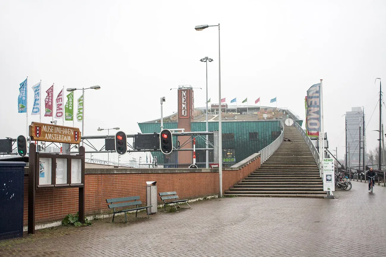
7. NEMO
The science museum in Renzo Piano's green, ship-shaped building over the entrance to the IJ tunnel, with hands-on floors and a sloping roof terrace over the old harbour.
Photo: "Amsterdam, NEMO Science Museum stairs" by Shadowgate (CC BY 2.0).
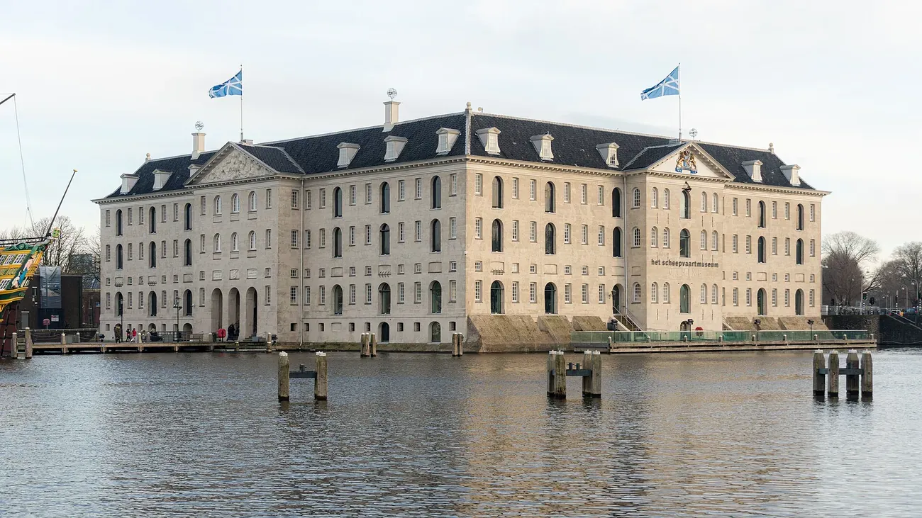
8. Maritime Museum
Het Scheepvaartmuseum tells the story of Dutch seafaring in a naval storehouse of 1656. A replica of the East India ship Amsterdam is moored outside.
Photo: "Nederlands Scheepvaartmuseum" by Fernando (CC BY-SA 4.0).
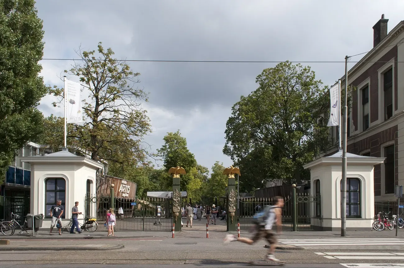
9. Artis Zoo
Founded in 1838, the oldest zoo in the Netherlands, among 19th century buildings in the Plantage, with an aquarium, a planetarium and Micropia, a museum of microbes.
Photo: "Artis entrance" by Zxempire (CC BY-SA 3.0 nl).
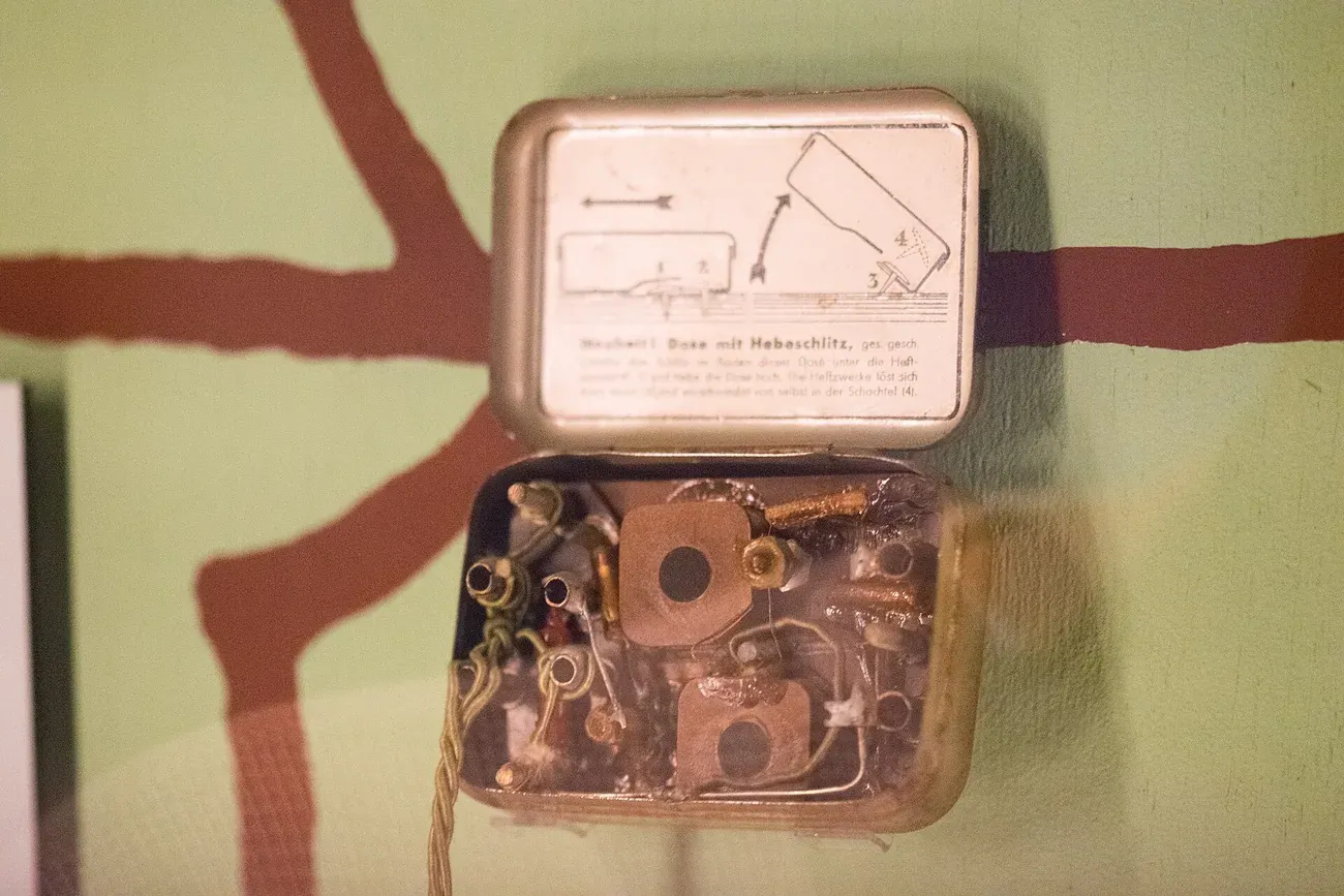
10. Resistance Museum
The Verzetsmuseum shows how people in the Netherlands lived through the German occupation of 1940 to 1945 and how some resisted it, with a separate part for children.
Photo: "Transmitter hidden in a tin" by Thomas Quine (CC BY 2.0).
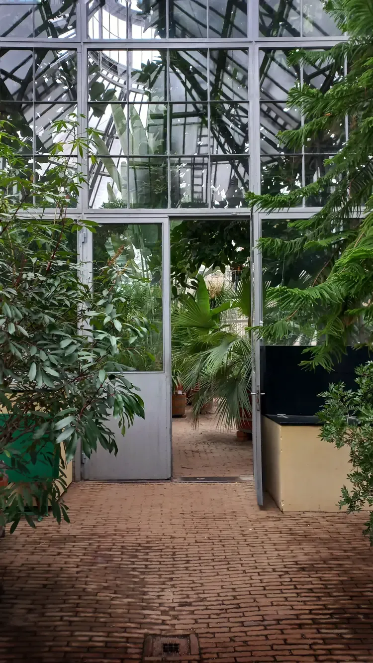
11. Hortus Botanicus
One of the oldest botanical gardens in the world, founded in 1638 as a physic garden, with glasshouses that include the Palm House and a greenhouse of three climates.
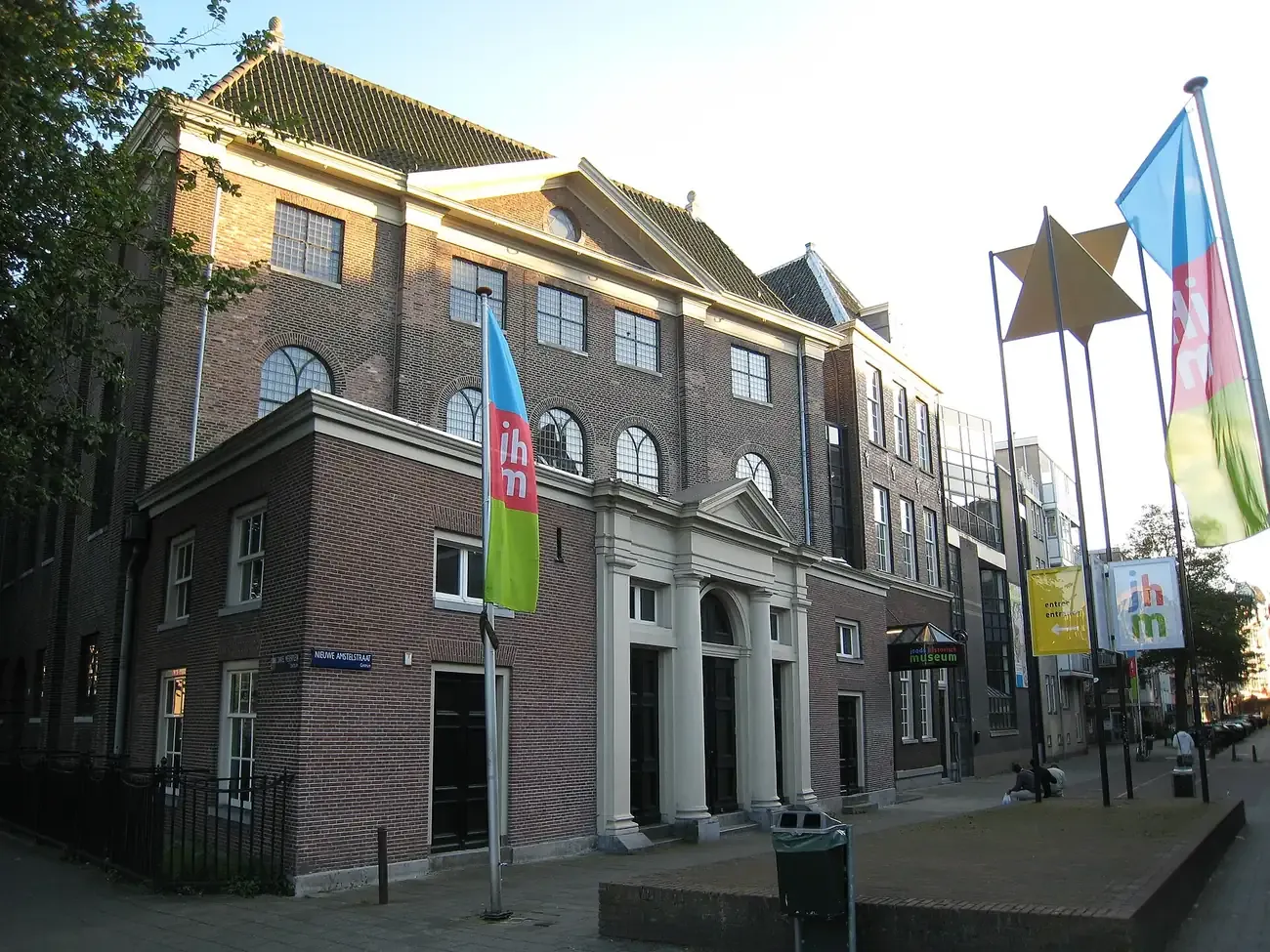
12. Jewish Cultural Quarter
Four sites around Waterlooplein share one ticket: the Jewish Museum, the Portuguese Synagogue of 1675, the National Holocaust Museum and the Hollandsche Schouwburg memorial.
Photo: "Joods historisch museum" by S Sepp (CC BY-SA 3.0).
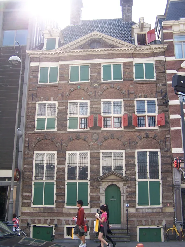
13. Rembrandt House
The house on the Jodenbreestraat where Rembrandt lived and worked from 1639 to 1658, furnished as in his day, with his studio and a large collection of his etchings.
Photo: "Amsterdam Jodenbreestraat 4" by Spider (CC BY-SA 3.0).
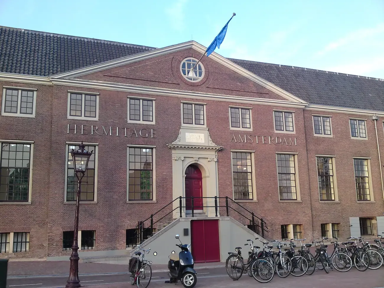
14. H'ART Museum
The museum in the Amstelhof, a 17th century almshouse on the Amstel, known until recently as the Hermitage Amsterdam. It shows exhibitions made with partner museums abroad.
Photo: "Hermitage Amsterdam - Ingang" by Fentener van Vlissingen (CC BY-SA 3.0).
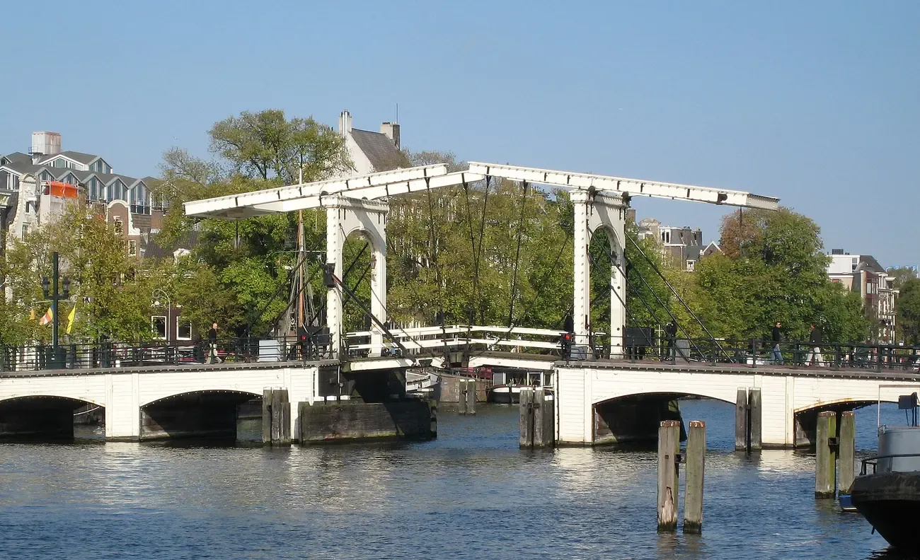
15. Magere Brug
The Skinny Bridge, a white wooden drawbridge over the Amstel between the Kerkstraat and the Nieuwe Kerkstraat, lit with rows of small bulbs after dark.
Photo: "Magere Brug" by S Sepp (CC BY-SA 3.0).
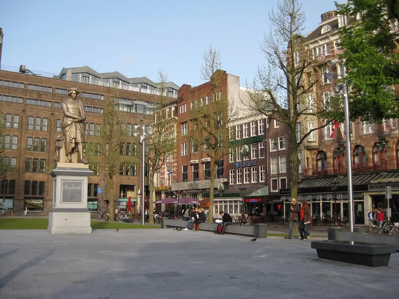
16. Rembrandtplein
A square of café terraces, bars and clubs around a statue of Rembrandt unveiled in 1852, one of the busiest spots in the centre at night.
Photo: "Nieuw Rembrandtplein" by Marion Golsteijn (CC BY-SA 3.0).
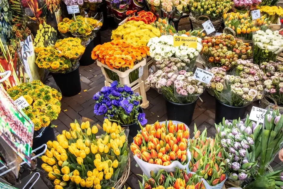
17. Flower Market
The Bloemenmarkt sells tulip bulbs, seeds and cut flowers from stalls on barges along the Singel, between the Muntplein, by the Munttoren tower, and the Koningsplein.
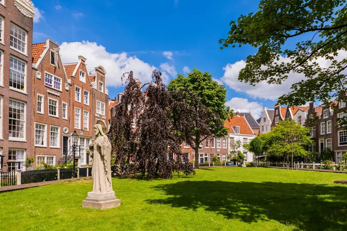
18. Begijnhof
A 14th century almshouse courtyard behind a door off the Spui, still lived in, with one of the two wooden houses left in the centre and the English Reformed Church. Visitors are asked to keep quiet.
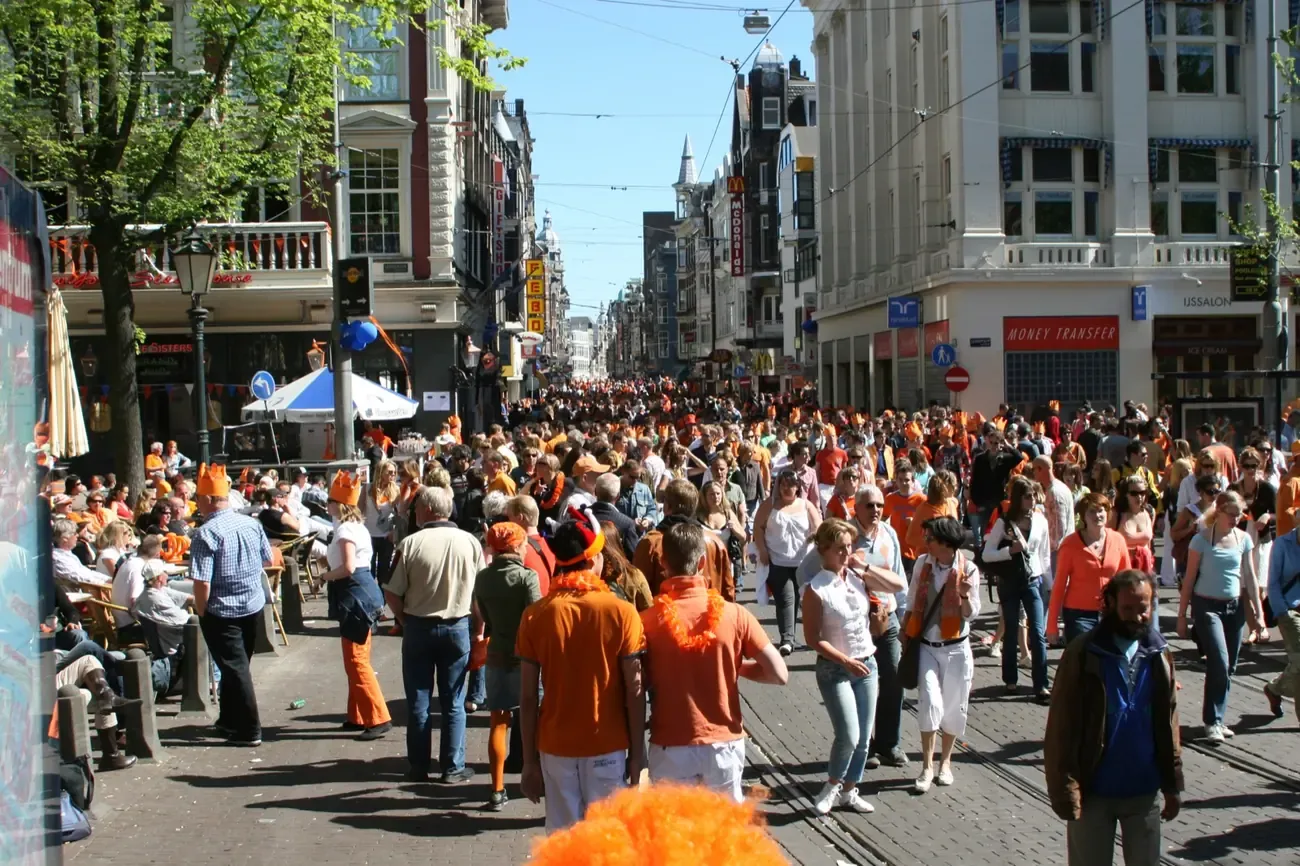
19. Leidseplein
A square of theatres, bars and street performers on the edge of the Canal Ring, with the Stadsschouwburg theatre on it and the Melkweg and Paradiso concert halls a few steps away.
Photo: "Leidseplein Amsterdam" by Yozza (CC BY 2.0).
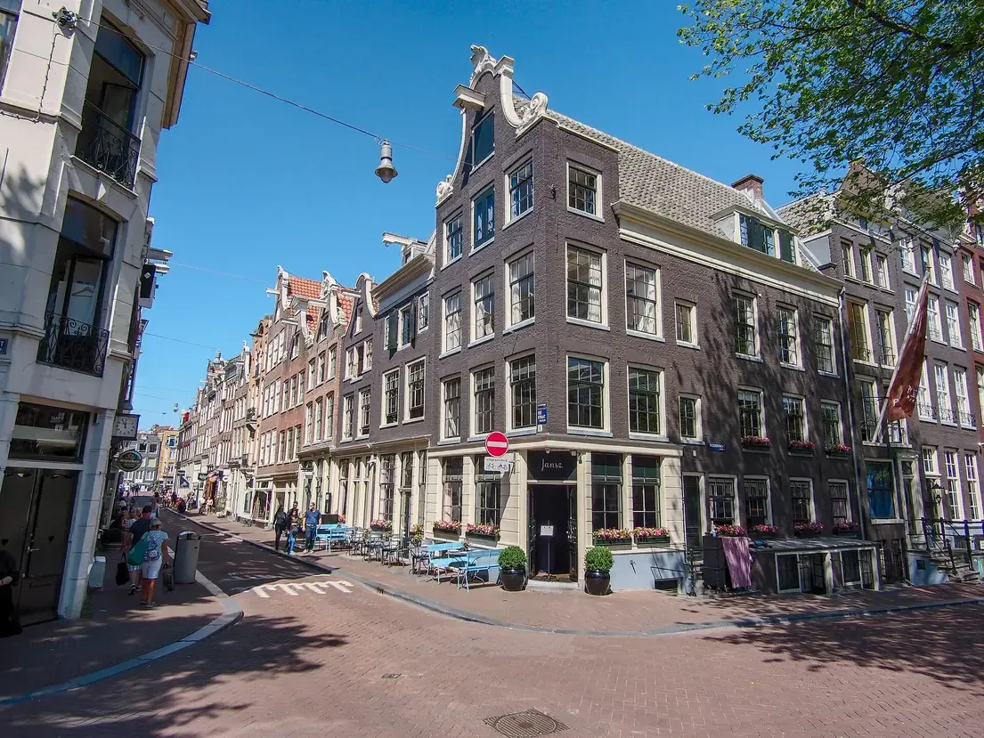
20. Nine Streets
De 9 Straatjes, nine short lanes across the Singel, Herengracht, Keizersgracht and Prinsengracht between the Raadhuisstraat and the Leidsegracht, with independent shops, vintage stores and cafés.
Photo: "Reestraat at the corner of the Keizersgracht" by Alf van Beem (Public domain).
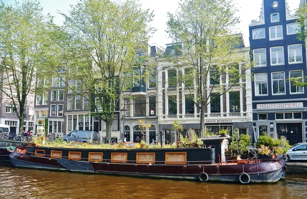
21. Houseboat Museum
A cargo barge of 1914 on the Prinsengracht, fitted out as a home, that shows how people live on the houseboats of Amsterdam's canals.
Photo: "Amsterdam Woonbootmuseum 2" by Zairon (CC BY-SA 4.0).
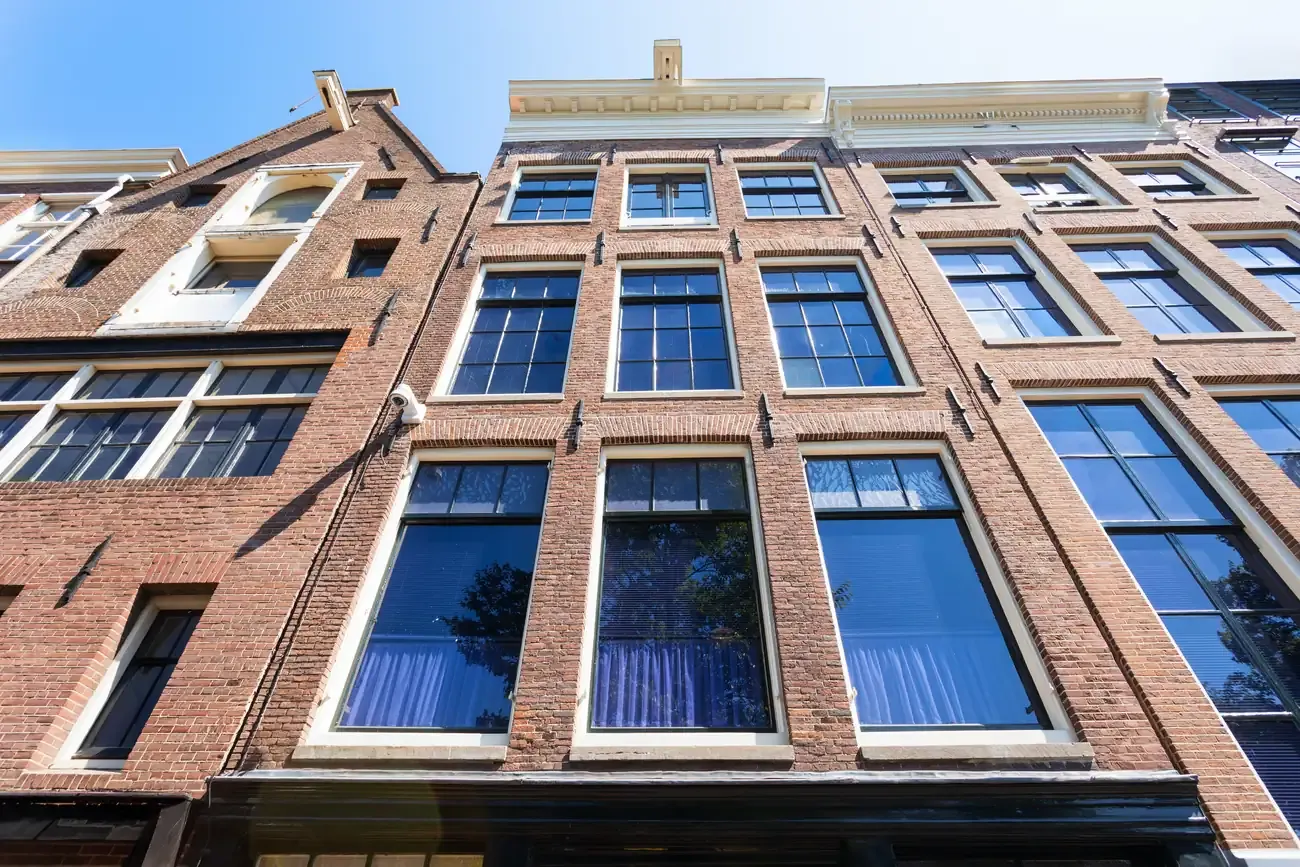
22. Anne Frank House
The canal house on the Prinsengracht where Anne Frank and her family hid in the secret annex from 1942 to 1944. Tickets are sold only online, for a set time.
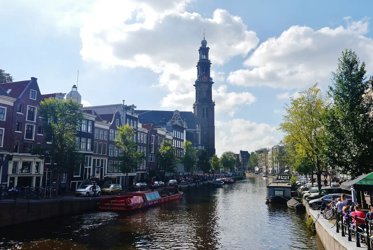
23. Westerkerk
A Protestant church completed in 1631, whose tower is the tallest church tower in Amsterdam. Rembrandt is buried inside, in an unmarked grave.
Photo: "Amsterdam Prinsengracht & Westerkerk 1" by Zairon (CC BY-SA 4.0).
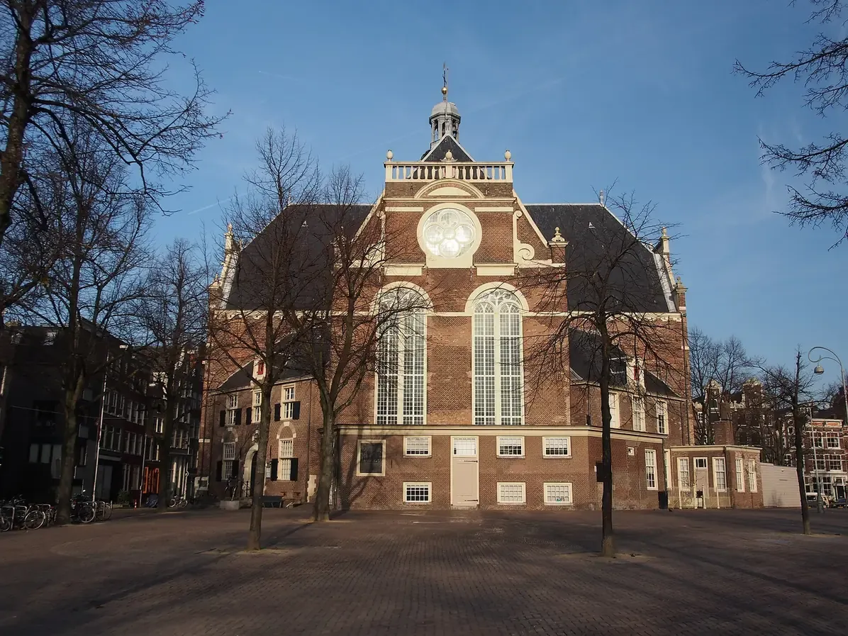
24. Noordermarkt
The square around the Noorderkerk at the top of the Jordaan, with a flea market on Monday mornings and a farmers' market on Saturdays.
Photo: "Noorderkerk, Noordermarkt" by Alf van Beem (Public domain).
Just outside the centre
Numbers 25 to 31, in orange on the map, sit across the Singelgracht in the Museum Quarter and De Pijp, or across the IJ in Noord.

25. Rijksmuseum
The national museum, in Pierre Cuypers' building of 1885, with Rembrandt's Night Watch and Vermeer's Milkmaid. It stands just across the Singelgracht, 8 minutes' walk from Leidseplein.

26. Van Gogh Museum
The largest collection of works by Vincent van Gogh, with paintings, drawings and letters, on Museumplein, 10 minutes' walk from Leidseplein. Tickets are sold online, for a set time.
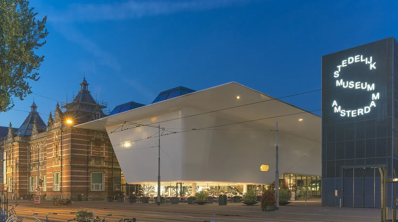
27. Stedelijk Museum
The museum of modern and contemporary art and design on Museumplein, in a building of 1895 with a white extension of 2012 nicknamed the bathtub. 12 minutes' walk from Leidseplein.
Photo: "De nieuwe vleugel van het Stedelijk Museum Amsterdam" by PressOfficeStedelijk (CC BY-SA 4.0).
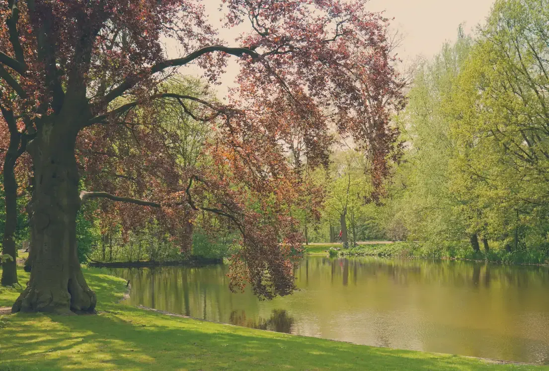
28. Vondelpark
The city's best-known park, opened in 1865, with ponds, lawns, a bandstand and an open-air theatre in summer. Its main gate is 6 minutes' walk from Leidseplein.
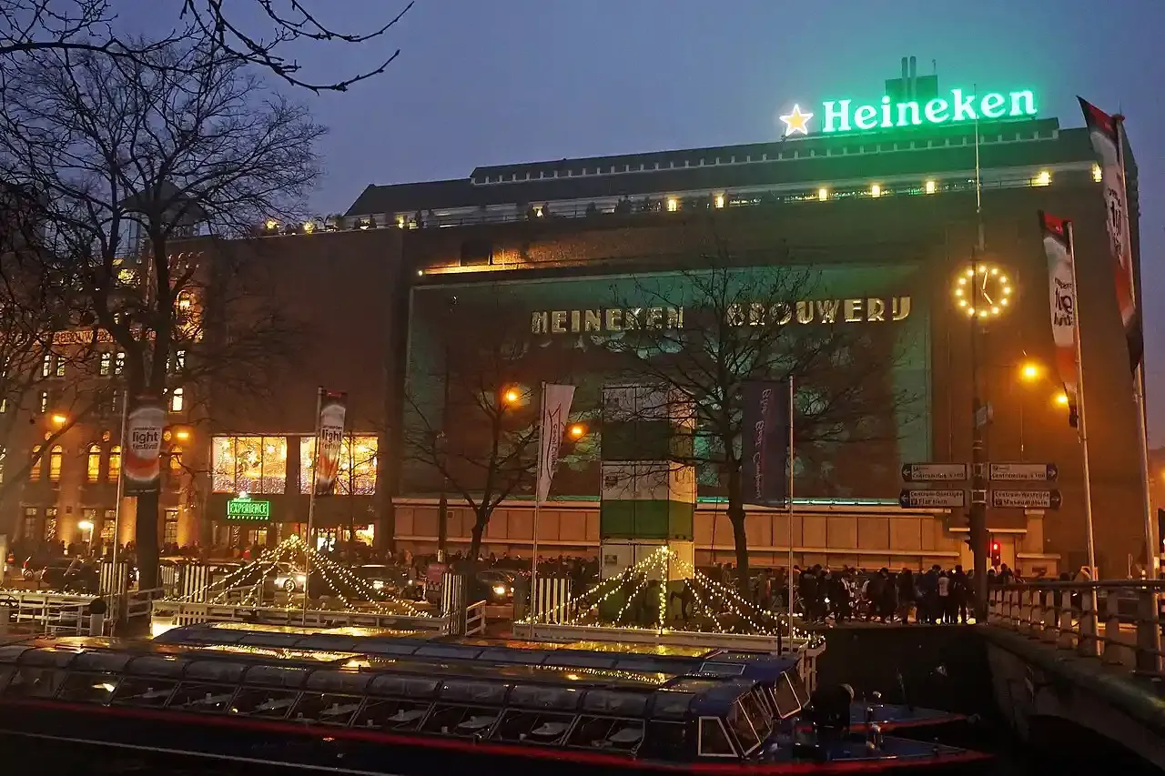
29. Heineken Experience
Heineken's brewery of 1867 on the Stadhouderskade, now a self-guided tour of the brand and of brewing, with drinks at the end. 7 minutes' walk from the Rijksmuseum.
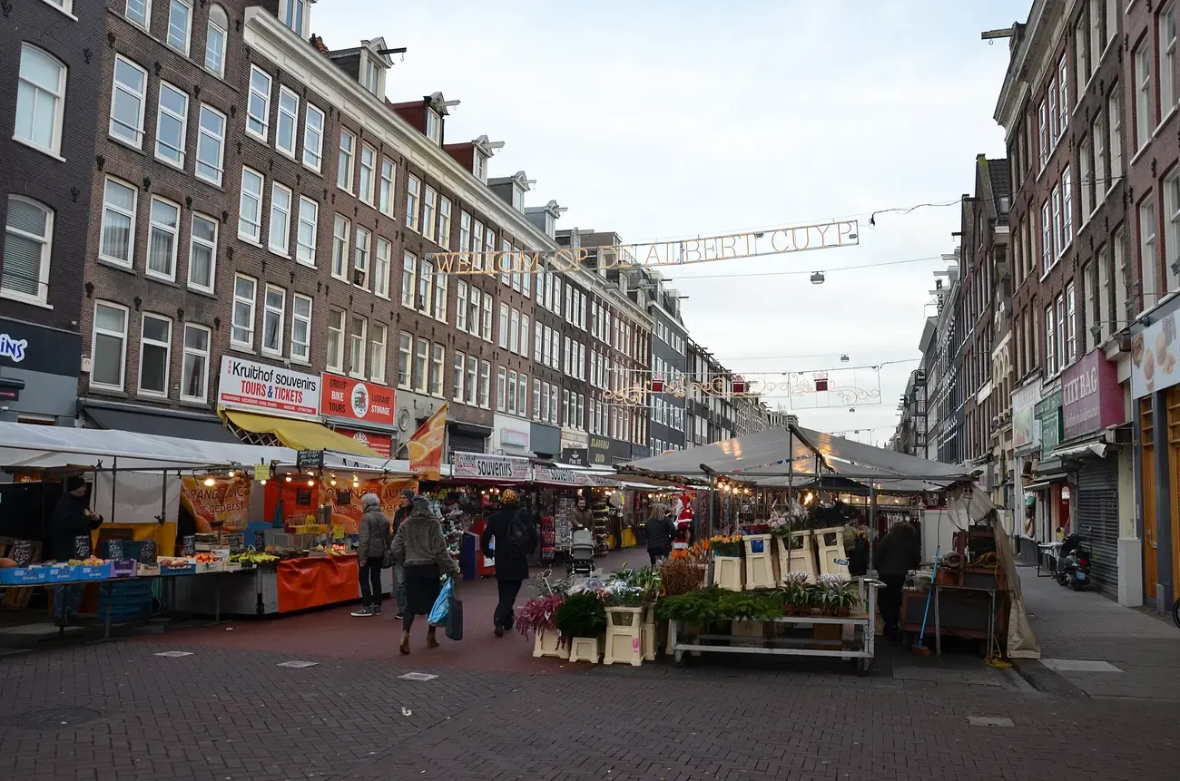
30. Albert Cuyp Market
A street market along the Albert Cuypstraat in De Pijp, open every day except Sunday, with food stalls, fabrics and flowers. 7 minutes' walk from the Heineken Experience.
Photo: "Albert Cuyp markt Amsterdam" by Steven Lek (CC BY-SA 4.0).
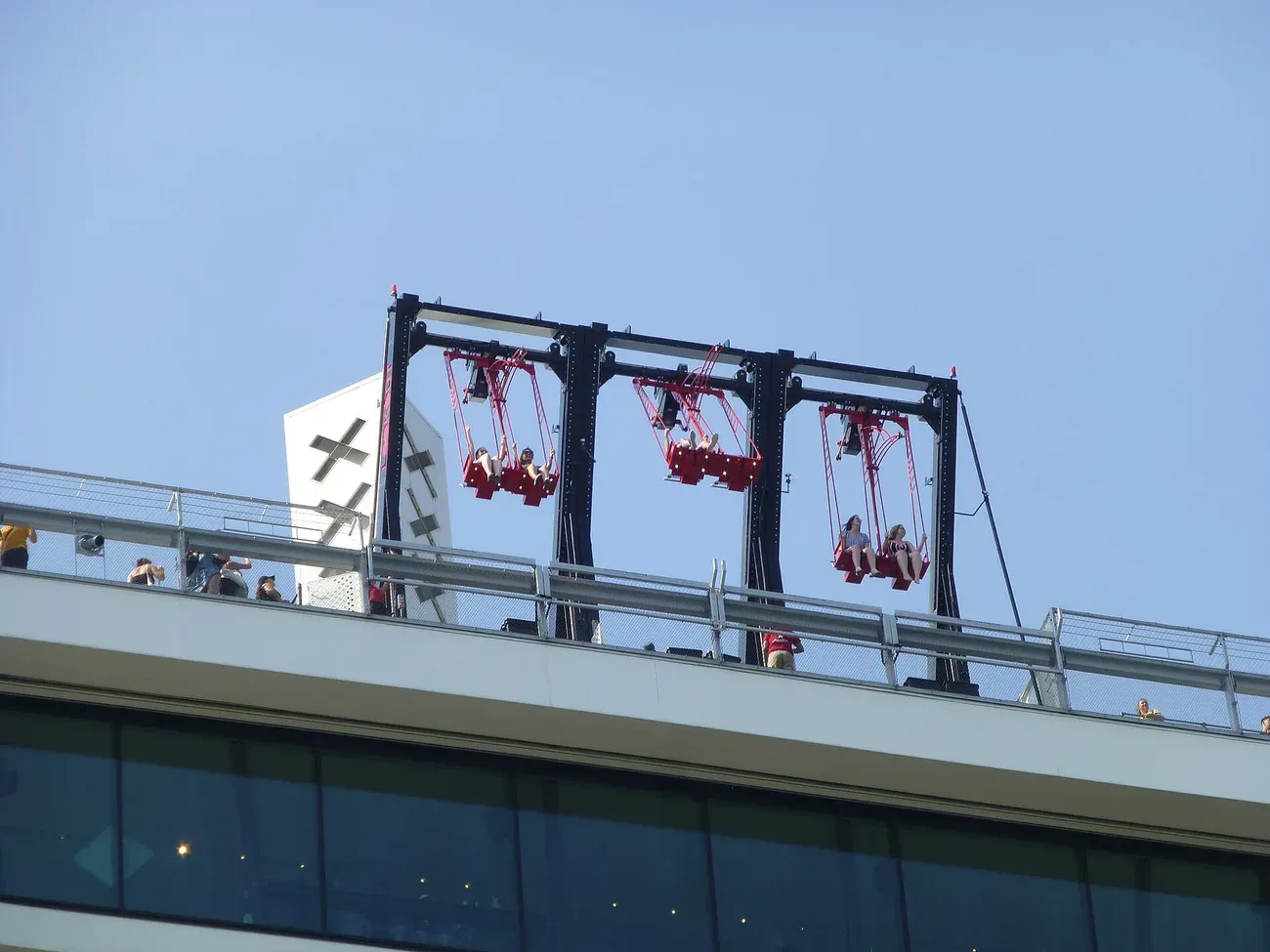
31. A'DAM Lookout
An observation deck on top of the A'DAM Tower across the IJ, with a swing over the edge. The free ferry from behind Amsterdam Centraal takes a few minutes.
Photo: "A'DAM Lookout and the Over the Edge swing" by Muck (CC BY-SA 4.0).
The printable Amsterdam city centre map
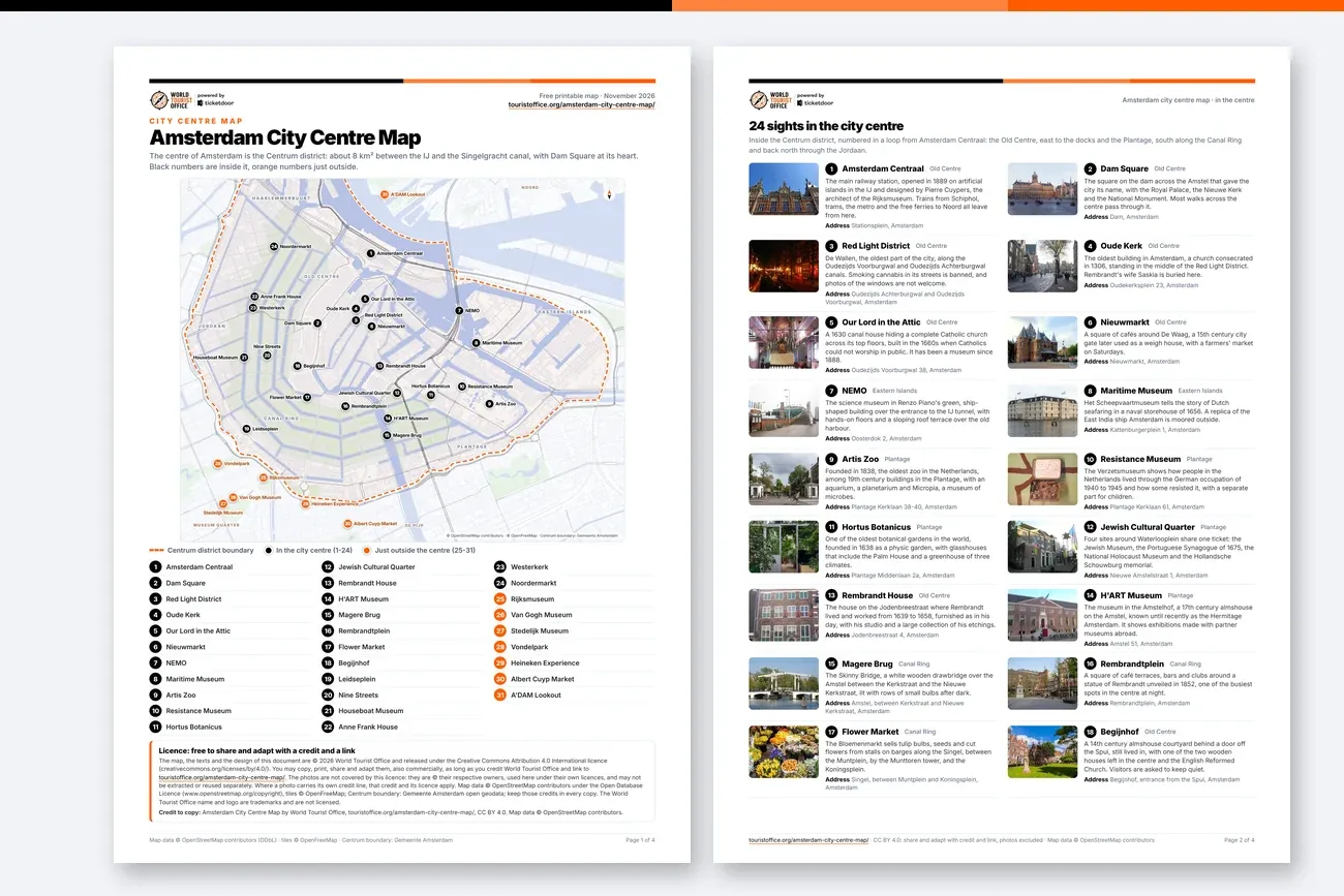
The printable Amsterdam city centre map
The PDF carries the same map with the 31 numbered sights, then a photo, a short description and the address of each one, how to get around the centre and the walking times between the main squares. In English, free to print and share. Edition: November 2026.
Getting around the centre of Amsterdam
- On foot: Amsterdam Centraal to Dam Square is 0.9 km, about 11 minutes, and the walk from the station to the Rijksmuseum, across the whole centre, takes about 33 minutes.
- By metro: Nieuwmarkt and Waterlooplein (lines 51, 53 and 54) serve the east of the Old Centre and the Plantage, and Rokin and Vijzelgracht (line 52) run south from the station under the Old Centre and the Canal Ring.
- By tram: trams from Amsterdam Centraal cross the centre by Dam Square and Leidseplein, and several lines stop at the Rijksmuseum and on Museumplein; the GVB network map shows which.
- By ferry: free ferries for people on foot and on bikes cross the IJ from behind Amsterdam Centraal; the one to Buiksloterweg runs day and night and lands by the A'DAM Tower.
- From Schiphol Airport: trains reach Amsterdam Centraal in about 15 minutes, and bus 397 runs to Museumplein and Leidseplein.
Canal cruises through the centre of Amsterdam
The Canal Ring is best seen from the water. These boat tours sail through the centre by day, in the evening, or with wine and cheese on board.
More maps and guides to Amsterdam
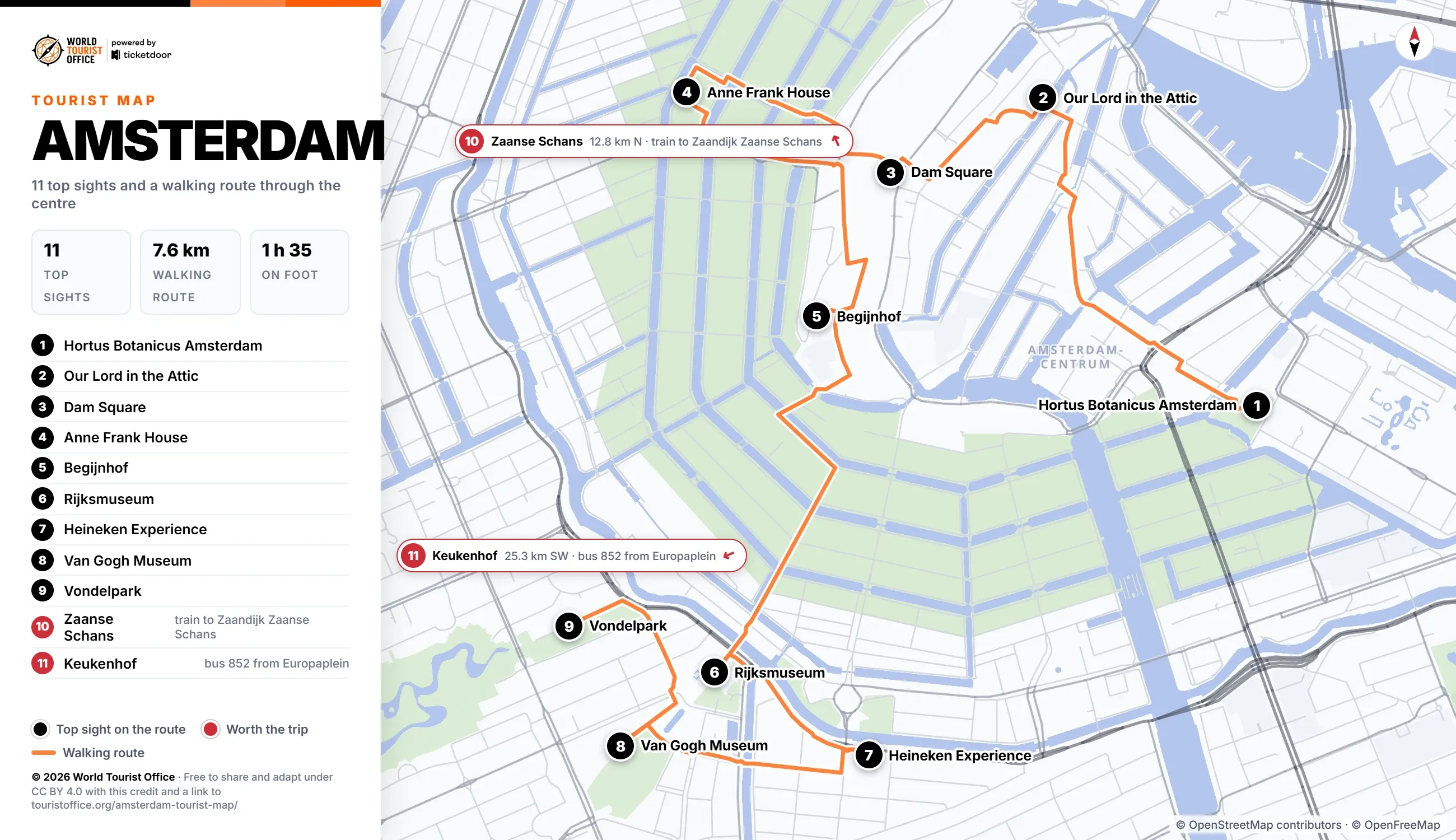
Amsterdam tourist map
Eleven top sights on a walking route from the Hortus Botanicus to the Vondelpark, with a printable PDF.
Things to do in Amsterdam
Opening details and tickets for the top sights, with free places, small museums and day trips.
Tourist office in Amsterdam
Where to find tourist information in Amsterdam, the city map and the public holidays of the year.
Licence
The map, the PDF and the texts are © 2026 World Tourist Office and free to copy, share, print and adapt, also commercially, under Creative Commons Attribution 4.0 International. The only condition is a credit to World Tourist Office with a link to this page.
The photos are not covered by this licence: they are © their respective owners, used here under their own licences, and may not be extracted or reused separately. Where a photo carries its own credit line, that credit and its licence apply. Map data © OpenStreetMap contributors (ODbL), tiles © OpenFreeMap, and the Centrum boundary comes from the open geodata of the City of Amsterdam: keep those credits too. The World Tourist Office name and logo are trademarks and are not licensed.
Plain text: Amsterdam City Centre Map by World Tourist Office, touristoffice.org/amsterdam-city-centre-map/, CC BY 4.0. Map data © OpenStreetMap contributors.